
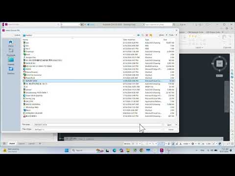
In the world of civil engineering and site design, efficiency is the key to a successful project. One of the most common tasks professionals face is moving survey data or coordinate lists from a spreadsheet into a design environment. If you have been manually entering data, you are losing valuable time. In this guide, we will explore the most effective ways to import Excel data into Civil 3D to ensure your project remains accurate and organized.
Why Integrate Excel with Civil 3D?
Excel is the industry standard for managing large datasets, while Autodesk Civil 3D is the powerhouse for infrastructure design. Connecting these two tools allows for seamless data transitions, reducing the risk of human error during manual entry. Whether you are dealing with point coordinates, pipe networks, or volume calculations, mastering the import process is essential for any modern designer.
Step-by-Step: Importing Points from Excel
The most frequent use case for importing data is bringing in point files. Here is how to do it correctly:
- Prepare Your Spreadsheet: Ensure your Excel data is organized into columns (e.g., Point Number, Easting, Northing, Elevation, Description).
- Save as CSV: Civil 3D prefers comma-delimited files. Save your Excel sheet as a .CSV (Comma Delimited) file to ensure compatibility.
- Use the Import Tool: Within your Autodesk software environment, navigate to the "Points" menu and select "Point Creation Tools."
- Select the Format: Click on the "Import Points" icon and choose the file format that matches your CSV layout (such as PNEZD).
- Add to Point Group: It is a best practice to add these points to a specific group immediately to keep your workspace organized.
Using Data Links for Dynamic Tables
If you need to display a table of data—such as a stakeout report or a summary of quantities—directly on your drawing, use the "Data Link" feature. This creates a live connection between your Excel file and Civil 3D. If you update the values in your spreadsheet, the table in your drawing will update automatically, ensuring your documentation is always current.
Final Thoughts on Workflow Optimization
By leveraging the interoperability of the Autodesk ecosystem, you can transform a tedious afternoon of data entry into a few simple clicks. Not only does this save time, but it also provides a level of precision that manual methods simply cannot match. Start integrating your spreadsheets today and take your Civil 3D projects to the next level of professionalism.
