Managing survey points and land measurement data manually can be a tedious and error-prone process. If you work in civil engineering or infrastructure design, mastering the data import workflow is essential for keeping your projects accurate and efficient. Fortunately, Autodesk Civil 3D offers a simple, powerful way to import point data directly from Microsoft Excel spreadsheets, saving you hours of manual data entry.
In this step-by-step guide, you will learn how to properly format your spreadsheet and successfully bring your survey coordinates into your design environment.
Step 1: Format Your Excel File Correctly
Before transferring data, your Excel file needs to follow a standard point structure. Civil 3D commonly uses formats such as PNEZD (Point Number, Northing, Easting, Point Elevation, Raw Description).
- Open your Excel spreadsheet.
- Arrange your data into clear columns:
- Column A: Point Number
- Column B: Northing
- Column C: Easting
- Column D: Elevation
- Column E: Description
- Delete all header rows, text titles, and blank rows so only raw numerical and text data remain.
- Go to File > Save As and save the document as a CSV (Comma Delimited) (*.csv) or Text (Tab Delimited) (*.txt) file. Native
.xlsxfiles cannot be read directly by the import wizard.
Step 2: Import Data into Civil 3D
Once your file is saved in the correct format, launch your software and follow these quick steps:
- Navigate to the Home tab on the main ribbon.
- Click on the Points drop-down menu and select Point Creation Tools.
- On the toolbar that appears, click the Import Points icon (the small icon with a green plus sign).
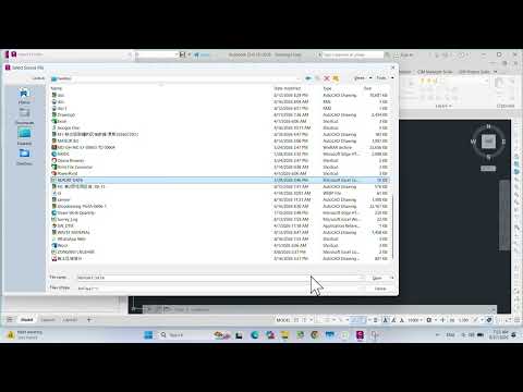
- In the dialog box, click the + (Add File) button to locate and select your CSV or TXT file.
- Under Specify Point File Format, scroll down and select the format matching your Excel structure (e.g., PNEZD (comma delimited)).
- Check the box to Add Points to Point Group if you want to organize these points together.
- Click OK. Type
ZE(Zoom Extents) into the command line to view your imported points instantly.
Streamline Your Engineering Workflow
Integrating spreadsheet data directly into Autodesk software minimizes human error and significantly speeds up project setup. By automating coordinate imports, you ensure high precision right from the initial survey phase.
Mastering this fundamental process allows you to focus on core design tasks rather than repetitive data input, making Autodesk Civil 3D an even more powerful asset in your daily workflow. Try this method on your next project to boost your productivity!


